 Lýsigagnagátt
NI_reit Líflandfræðileg svæði fyrir sveppi
Gagnasafn (GDB) NI_reit_v_LiflandfraedilegSvaedi_sveppir:
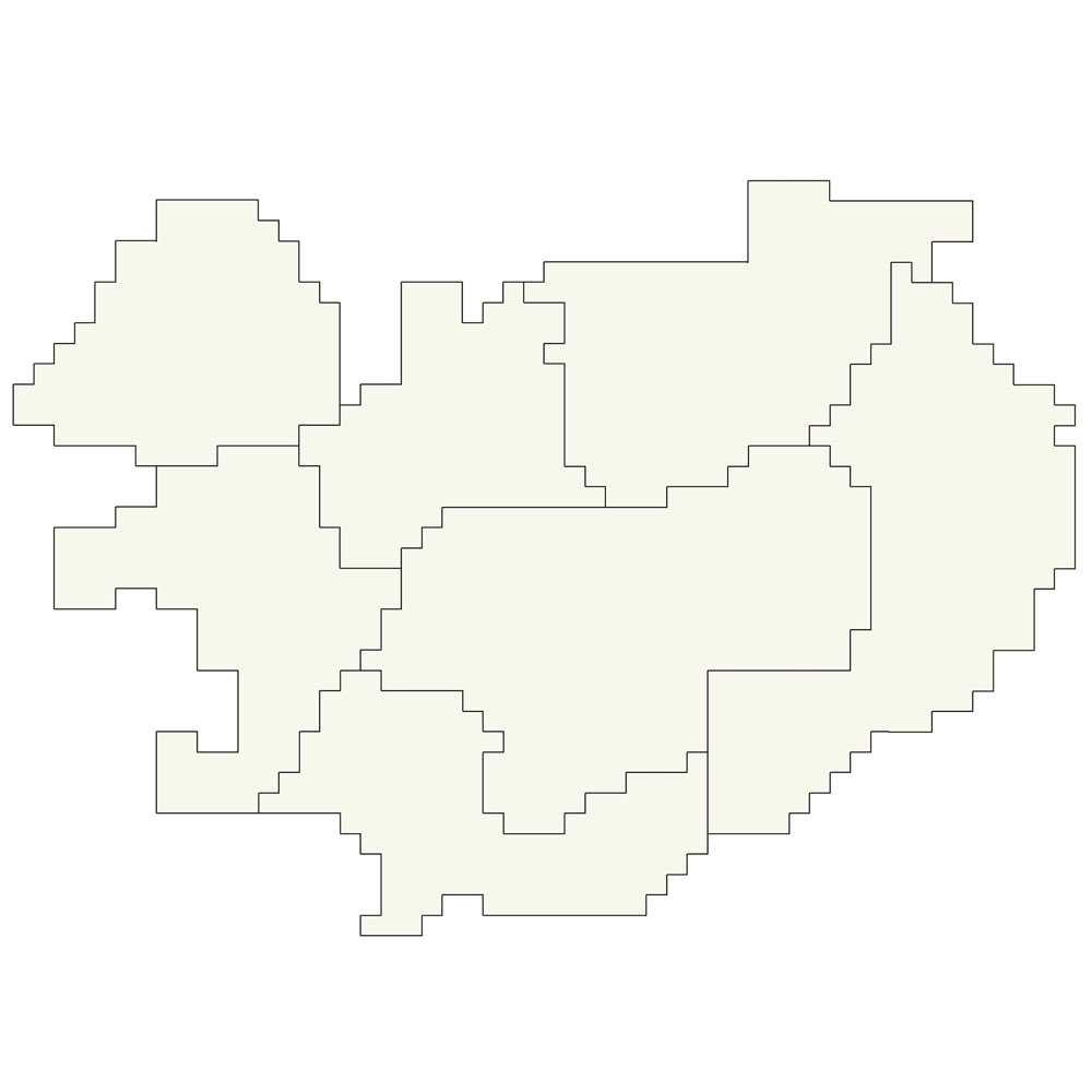
Líflandfræðileg svæði fyrir sveppi [Bio-geographical provinces for fungi in Iceland].
Reitakerfið er notað til að sýna grófa útbreiðslu sveppa eftir landshlutum og byggir á 10 km reitakerfi NÍ. Fláka- og línulag.
Simple
- Date (Revision)
- 2008-01-01
- Citation identifier
- {391AE300-FF75-4ADF-99D6-3B4F44728558}
- Status
- Completed
- Point of contact
-
Organisation name Individual name Electronic mail address Role Náttúrufræðistofnun – Natural Science Institute of Iceland
Point of contact
- Theme
-
-
Landfræðileg reitakerfi
-
Geographical grid system
-
Líflandfræðileg svæði
-
Bio-geographical regions
-
Tölfræðilegar einingar
-
Statistical units
-
GSL
-
INSPIRE
-
- Use constraints
- Other restrictions
- Other constraints
-
https://www.natt.is/is/midlun/opin-gogn
Gögnin eru öllum opin – no limitations on public access
- Access constraints
- Other restrictions
- Other constraints
- no limitations to public access
- Spatial representation type
- Vector
- Denominator
- 5000000
- Language
- English
- Topic category
-
- Biota
- Environment
))
- Reference system identifier
- http://www.opengis.net/def/crs/EPSG/0/3057
- Distribution format
-
Name Version ESRI ArcGIS FileGDB
10.2.0.3389
Digital transfer options
- OnLine resource
-
Protocol Linkage Name WWW:LINK-1.0-http--link
https://www.natt.is/is/grodur/sveppir Vefur Náttúrufræðistofnunar: Sveppir
WWW:LINK-1.0-http--link
https://www.natt.is/is/rannsoknir/voktun-og-rannsoknir/funga-islands-sveppir Vefur Náttúrufræðistofnunar, Rannsóknarverkefni: Funga Íslands
WWW:LINK-1.0-http--link
https://www.natt.is Vefur Náttúrufræðistofnunar
- Hierarchy level
- Dataset
Conformance result
- Title
-
Commission Regulation (EU) No 1089/2010 of 23 November 2010 implementing Directive 2007/2/EC of the European Parliament and of the Council as regards interoperability of spatial data sets and services
- Date (Publication)
- 2010-12-08
- Explanation
-
Validation has not been performed.
- Pass
- No
- Statement
-
Reitakerfið byggir á 10 km reitakerfi NÍ. The prior edition was used in Sveppatal I, this version was used in Sveppatal II and Funga Nordica. The change from Sveppatal I to II is: the central regions Mn and Ms are combined to the province Mi.
Metadata
- File identifier
- {B7983EC5-1983-449B-B37A-07C7F5E0FFD7} XML
- Metadata language
- English
- Hierarchy level
- Dataset
- Date stamp
- 2025-08-08T14:06:06
- Metadata standard name
-
INSPIRE Metadata Implementing Rules
- Metadata standard version
-
Technical Guidelines based on EN ISO 19115 and EN ISO 19119 (Version 1.2)
- Metadata author
-
Organisation name Individual name Electronic mail address Role Náttúrufræðistofnun – Natural Science Institute of Iceland
Point of contact
)))